Canmore Site 52510: EDINBURGH, HOLYROOD PARK, DUNSAPIE - EDINBURGH (EDINBURGH, CITY OF) - FIELD BOUNDARY (PERIOD UNASSIGNED), FORT (LATER PREHISTORIC)
Description
| Site Name | EDINBURGH, HOLYROOD PARK, DUNSAPIE |
|---|---|
| Other Name(s) | THE KING'S PARK, QUEEN'S PARK, DUNSAPIE CRAG, DUNSAPIE LOCH |
| Site Number | NT27SE 49 |
| Broad Class | AGRICULTURE AND SUBSISTENCE, MONUMENT (BY FORM), DEFENCE, DOMESTIC |
| Site Type(s) | FIELD BOUNDARY (PERIOD UNASSIGNED), FORT (LATER PREHISTORIC) |
| NGR | NT 28172 73166 |
| NGR accuracy | NGR given to the nearest 1m |
| Local Authority | EDINBURGH, CITY OF |
| Parish | EDINBURGH (EDINBURGH, CITY OF) |
| Record created | 1988-05-03 |
| Last updated | 2022-08-03 |
Archaeology Notes
NT27SE 49.00 2818 7315
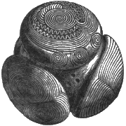
NT27SE 49.01 2818 7315 stone mould
See also NT27SE 102.
(NT 2818 7315) Dunsapie (NAT) Fort (NR)
OS 6" map, (1966)
(Location cited as NT 282 731). The remains of this fort crown the rocky hill which borders the E side of Dunsapie Loch. The walls have been most severely robbed of stone, but sufficient remains to show that originally the summit of the hill was bordered by a wall and the E flank by another. Whether they were contemporary might be determined by excavation, but there is no reason to suppose that they were not. The summit area measures about 350 ft [107m] by a maximum width of 200 ft [61m], being bordered on the W and N by precipitous crags and on the other sides by the spread remains of the inner wall. The outer wall is visible below the steep crags bordering the W margin of the summit, running thence S and E round the prolonged E toe of the hill, where the entrance lies. It runs NW from this, rising up the margin of the toe of the hill, until at a point 200 ft [61m] SE of the NE angle of the summit enclosure, it fades away as its line is replaced by steep crags. Several platforms in in the E part of the interior lying between the outer and inner walls suggest stances for Early Iron Age timber-framed houses.
R W Feachem 1963.
The fragmentary remains of a fort occupy the top of Dunsapie Crag. The crag declines in a steep grassy slope to the E, but is precipitous in other directions. A wall ran near the edge of the more precipitous parts, where it is now represented chiefly by footings and small stones, and along the top of the E slope, where it forms in places quite a massive bank. A pear-shaped area some 350' x 200' is enclosed. From the NE corner, a horn-work seems to have run downhill to crown a shoulder of rock: footings indicate a wall 9' thick. The shoulder overlooks a path which may therefore mark the original approach.
An outer wall is visible below the steep crags bordering the W margin of the summit, running thence S and E round the prolonged E side of the hill. It runs NW from this, rising up the margin of the toe of the hill until, at a point 200' SE of the NE angle of the summit enclosure, it fades away as its line is replaced by steep crags. Whether this wall and that on the summit were contemporary might be determined by excavation, but there is no reason to suppose that they were not (Feachem 1963). The outer wall thus forming a large annexe E of the fort. The entrance through the outer wall is in the NE, close to that of the inner. The only other gap in the outer wall is the demonstrably secondary entrance to the scooped enclosure noted on NT27SE 145.
Several platforms in the E part, between the outer and inner walls suggest stances for Early Iron Age timber-framed houses (Feachem 1963). The summit area is divided into three small areas by slightly different natural levels. That to the N is the largest and roughly circular. From a kitchen midden on it came a stone mould for casting rings and brooches, shells, animal bones, vitrified matter etc, which were donated to the NMAS in 1872 (Acc Nos: HR 15 - 39). The vitrified matter seems to have been the result of numerous fires kindled here and there over the area (PSAS 1873).
The other two summit levels are crescentic in form.
Proc Soc Antiq Scot 1873; R B K Stevenson 1949; RCAHMS 1951; R W Feachem 1963; R W Feachem 1965.
The fragmentary remains of this fort are generally as described. The entrance is in the NE. Internally numerous platforms may represent the sites of houses too indistinct for survey. A platform 12.0 x 8.0m exists in the S angle.
Surveyed at 1:2500.
Visited by OS (S F S) 9 December 1975.
Identifiers and Links to Other Records
This record has no links! Would you like to help?
| Identifier / External Link | Linked Record | Status | Comment |
|---|---|---|---|
| Canmore Site Number (legacy): NT27SE 49 | No linked record |
This area is visible only to logged in users.
